
Walk a Schererville Street Directory
A Schererville address search works best as a chain, not a one-box answer. The Lake County Assessor Engage portal accepts an owner, address, or property number and returns parcel results. The county GIS then separates the situs address, which means the physical parcel location, from the owner's mailing address. A Recorder instrument can confirm a transfer, while a dated directory can support occupancy at a past point in time. Keep those findings separate. A deeded owner may be a trust, estate, company, or person who receives mail elsewhere.
- Standardize the street address with USPS, but save the spelling supplied by the searcher.
- Search a distinctive street fragment in Engage. Page through the results, then narrow by house number.
- Open the matching parcel in the county GIS and record its PIN, situs city, municipality, ZIP, and legal description.
- Follow the parcel's Recorder link when ownership history matters. Note the instrument date and legal land description.
- For a dated occupant, consult voter access rules or a criss-cross volume rather than treating the owner field as proof of residence.
This street-by-street method guards against similar road names and parcels beyond Schererville limits. It also makes the evidence easy to audit: save the portal, field label, parcel number, and date. The Lake GIS map helps with orientation, but its own disclaimer says it is not a survey. A legal boundary dispute requires the recorded plat or other authoritative land record.
Search Schererville Streets in Engage
The basic Engage search is the strongest first pass for a modern Schererville street directory. Partial text can match owner, address, or property number, and result pages offer 25, 50, or 75 rows. Broad fragments may bring back like-named streets or places outside town, so open the detail rather than relying on the result line. Advanced Search serves a different task. Its optional filters include sale price and date, assessed value, neighborhood, district, building style, property class, year built, living area, acreage, bedrooms, stories, and plan.
| Search control | Type | Required | How to use it |
|---|---|---|---|
| Owner, Address, Property Number | Text | Not marked | Enter a partial street, exact number, owner, or PIN. |
| Page size | Choice | Not marked | Show 25, 50, or 75 matching parcels. |
| Sale and value ranges | Number/date | Optional | Narrow property traits, not occupants. |
| Neighborhood and district | Choice | Optional | Compare county property groupings. |
Engage states that its summary data updates monthly, while the property-record-card PDF follows an annual cycle. That timing can explain a mismatch after a recent transfer. Confirm a legal ownership point in the Recorder instrument, not by assuming the tax card is current to the day.
Read Schererville GIS Address Fields
The Lake County parcel viewer adds the labels a street directory needs. Its layer exposes the parcel ID, deeded owner, physical street components, owner mailing components, municipality, tax code, legal description, acreage, and links back to the Assessor, Treasurer, and Recorder. Search by PIN or address when possible, click the parcel polygon, and then inspect nearby parcels one at a time. The place-finder control was disabled during research, so Engage is the safer entry point.
- Parcel or PIN
- The county's identifier for a piece of land. Do not guess how its number groups decode.
- Situs address
- The physical location assigned to the parcel, distinct from where the owner receives mail.
- Plat
- A recorded map that shows lots, streets, and other surveyed divisions.
- Criss-cross directory
- A dated directory organized by street or address rather than only by surname.
The layer also offers historic aerial years and recent building footprints. They can show when a road or structure appeared, but never identify an occupant. Record the layer date and retain the map's as-is, not-a-survey warning.
Schererville Street Mailing Mismatches
A locally verified parcel demonstrates why street records need precise labels: the GIS showed a Schererville situs and ZIP 46375, but a Griffith mailing city and ZIP 46319. That does not move the land out of Schererville. It shows that the tax-mail destination and physical parcel are separate data points. The county layer's IncMuni field supplies the incorporated municipality, while USPS answers postal delivery questions.
Use this distinction throughout a Schererville street directory. Label a mail result as an owner or tax-account mailing address. Label Locstreet and Loccity as situs data. Then use the legal description and parcel shape when continuity matters. This small discipline prevents a common error: calling the place where a bill is mailed the residence of a named person.
Note: Postal city, parcel situs, incorporated municipality, township, and service area may describe the same property differently without any record being wrong.
Schererville Records Searchable by Street
Several public systems accept a Schererville address, but each has a narrow role. The Assessor and GIS identify land. The Treasurer supplies tax-account context. The Recorder confirms filed instruments. Town files may document construction or a road project. Indiana's public voter portal does not offer bulk street searching, so any walking-list request follows Lake County Elections and VRG-24 rules instead.
| Address record | Official keeper | What it can show | Access route |
|---|---|---|---|
| Parcel and assessment | Lake County Assessor | Owner field, situs, PIN, value, record card | Free Engage search |
| Parcel geography | Lake County GIS | Parcel shape, municipality, mailing/situs fields, legal description | Free viewer and feature layer |
| Tax account | Lake County Treasurer | Location and mailing search context | Free tax search |
| Recorded instruments | Lake County Recorder | Deeds, liens, releases, plats, leases, mortgages | Free account; images may cost |
| Permits and projects | Schererville Planning/Building or Public Works | Releasable applications, plans, dates, notices | Document center or APRA request |
The Lake County Treasurer tax search offers Real Property Number, Personal Property Number, Owner or Business Name, Last Name, Mailing Address, and Location. Its instructions favor fewer words and spellings without symbols. A Treasurer match is an account record, not proof of who occupies the parcel.
Confirm Schererville Street Owners
The Lake County Recorder portal holds the filed-document side of the Schererville street directory. Free registration comes before search. The public description says the collection spans more than two centuries and more than three million documents, although the exact online image cutoff was not visible before login. Search methods include a one-line search and separate fields. When a parcel link identifies an instrument, compare its document number, recording date, legal description, grantor, and grantee with the property record.
A grantor transfers an interest, while a grantee receives it. Neither role alone proves that the person lived at the street address. Portal images are described as noncertified and may not be fully current. Online images cost $1 per page plus a $3 administrative charge per order in the researched guidance. Request a certified copy from the custodian when legal proof matters.
Lake County began electronic recording in March 2021, and the Recorder reports that more than half of instruments now arrive that way. That change can make newer filings easier to locate while older deeds, plats, and liens still require index, image, or office work.
Request Schererville Address Files
No public online Schererville building-permit index was found. That gap has a clear fallback. Search the town document center for dated planning, zoning, road, utility, and meeting records. Then send the Schererville APRA request form to the department that keeps the file. A useful request names the exact address or PIN, permit or case type, date range, and whether inspection or copies are wanted.
Permit requirements show that a releasable file may include a legal description, survey plats, plans, setbacks, flood-zone information, grades, drainage, decks, fences, pools, and work dates. Some plans or personal details may be withheld or redacted. Ask for the record category tied to the parcel, not every file about a named person. The town form lists email, fax, or pickup delivery and a standard-page copy fee of $0.15, paid in advance.
Schererville Streets Across Time
Schererville's Crossroads of the Nation history affects old address searches. Town history links Joliet Street to the original Lincoln Highway and identifies early travel at the US 30 and US 41 junction. An old listing may use Joliet, Lincoln Highway, a route label, or a regional telephone exchange. No authoritative townwide renumbering or alias table was found, so never convert those forms by guess.
Bridge an old address with a dated telephone or criss-cross directory, a recorded plat, a town map, and current GIS. The 1959–60 Calumet Region directory scan is useful, but its OCR includes errors and must be checked against the page image. The Schererville city directory collections provide the historical shelf, while the street search remains focused on matching an address to the right parcel.
Annexation also changes the record context. Official planning material documents a southern tract annexed in 2018, and later town records identify Ordinance 1963 for contiguous land at 11245 W 80th Court. Use the ordinance date for a boundary question rather than assuming today's municipal line always applied.
See Schererville Street Search Screens
The captured Lake Assessor advanced search shows the property filters available beyond a basic address.
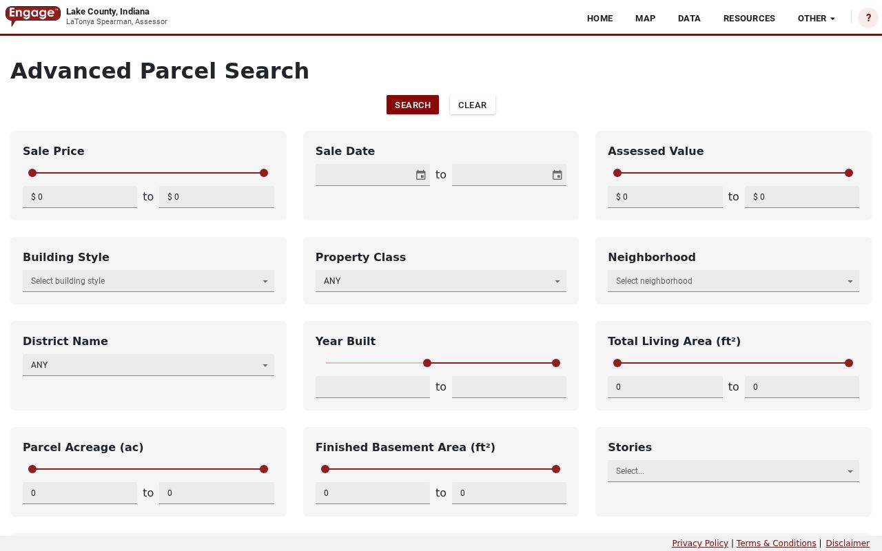
The screen confirms that property traits are optional search controls, not fields that identify household members.
The Treasurer property tax search provides the separate Location and Mailing Address routes.
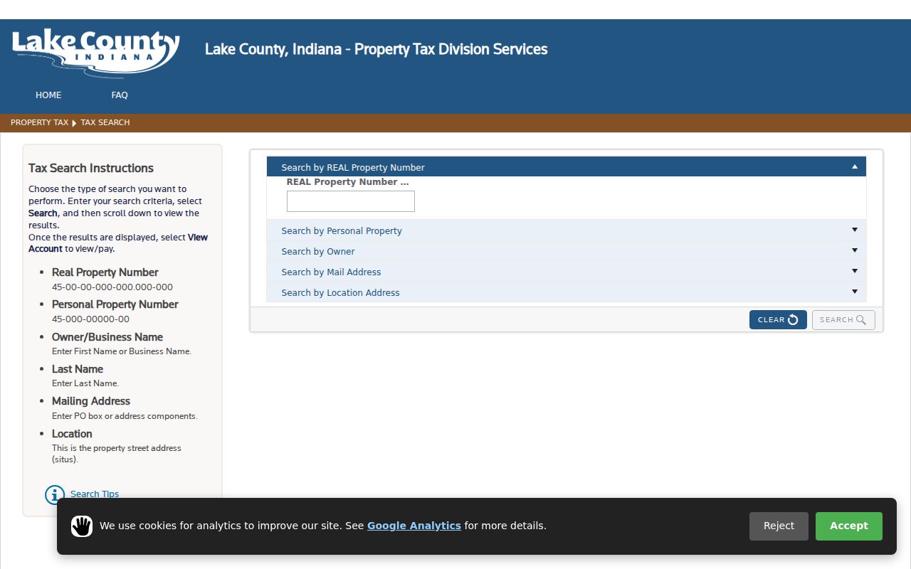
Its labels reinforce why a Schererville street directory must not merge the parcel location with a tax mailing destination.
The county's parcel feature service exposes the field schema behind map results.
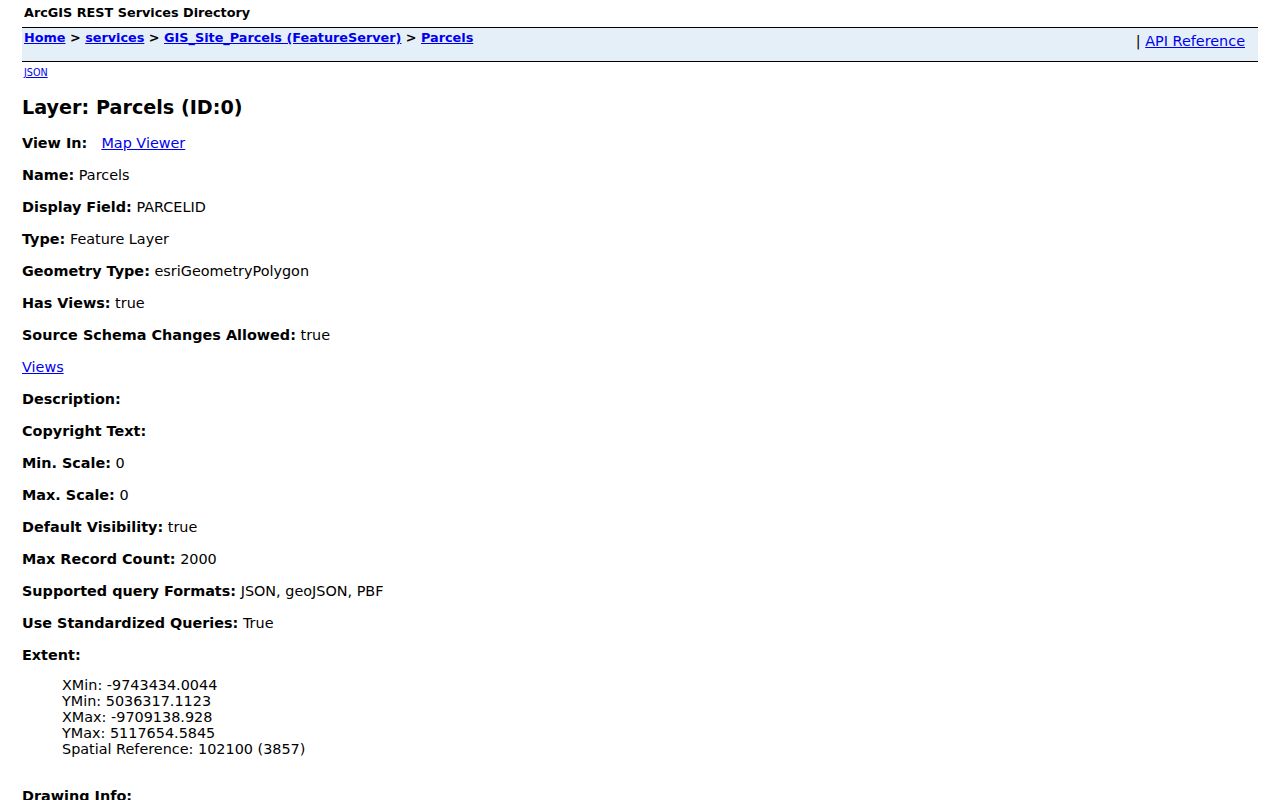
Those fields preserve owner, situs, mailing, legal, and municipality values as distinct evidence.
Schererville Street Directory Limits
Public property tools do not make a complete list of current Schererville residents. Owner names, exemptions, assessed values, mailing addresses, and map popups are administrative facts. None proves that a person occupies the property today. Renters and household members are not gathered in one open government index. Indiana Voters verifies an individual registration through identity fields, not a whole street, and broader voter-file access follows VRG-24 limits. Motor-vehicle address data is restricted, while utility customer lists are not public resident directories.
Stop when a protected address is suppressed. Indiana's Address Confidentiality Program exists to keep a survivor's actual address out of public-facing processes. Do not infer it from nearby parcels or other records. Use official rolls for a focused, lawful purpose, cite what each record truly says, and avoid publishing a household roster.
Lawful use. Schererville address records support family research, property questions, and civic review. Never use them to stalk, harass, threaten, or expose a protected person.